


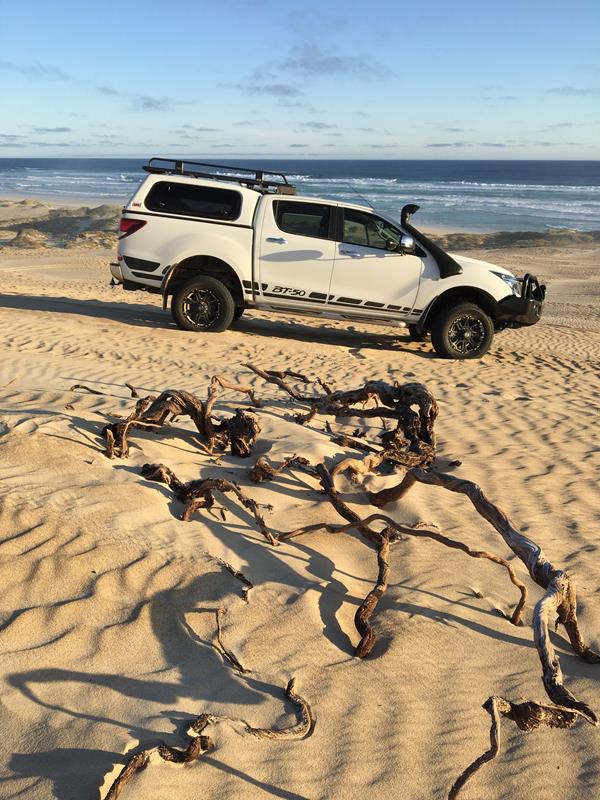
Not only is Coffin Bay township and its near surrounds an extraordinarily beautiful place to visit but the adjacent National Park is a true gem. If you’re lucky enough to own a 4WD you’ll be able to get really close to nature and sample one of the best coastal experiences you’ll find anywhere in the country if not the world. The trails that criss-cross the park offer some challenges for different reasons at different times of the year and make a stay in the park for a day or a week a whole lot of fun.


The Coffin Bay Township is 45 kilometres west of Port Lincoln. Port Lincoln is a well-serviced town that supports its fishing and agriculture industries with excellent engineering and transport infrastructure and is handy enough to race back to for spares and repairs from Coffin Bay if needed.
Coffin Bay has everything a holiday-maker might want for a stay, from a caravan park with powered and unpowered sites and cabins, to traditional motel style accommodation thanks to Long Beach Holiday Apartments and plenty of holiday rental homes accessed via Coffin Bay Holiday Homes. There are plenty of comfy places to stay in or you can camp in the National Park. Both the new IGA Supermarket that used to be known as the General Store and the Beachcomber have fuel, fast food and of course, oysters.


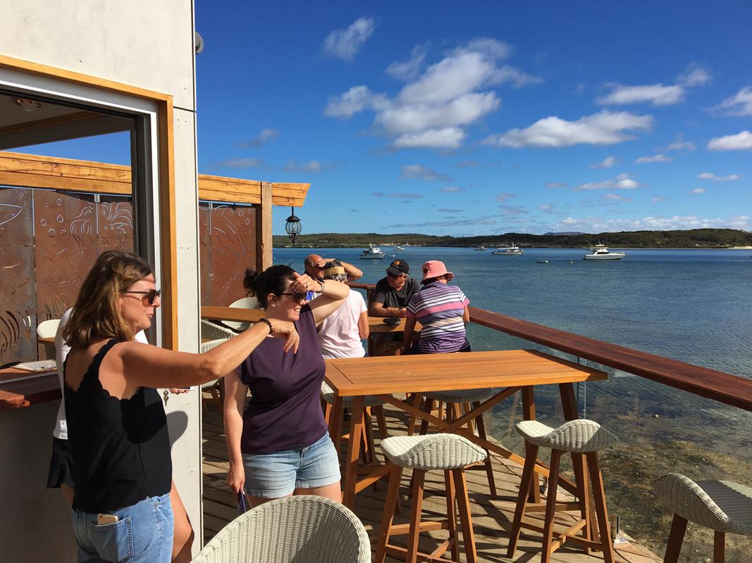

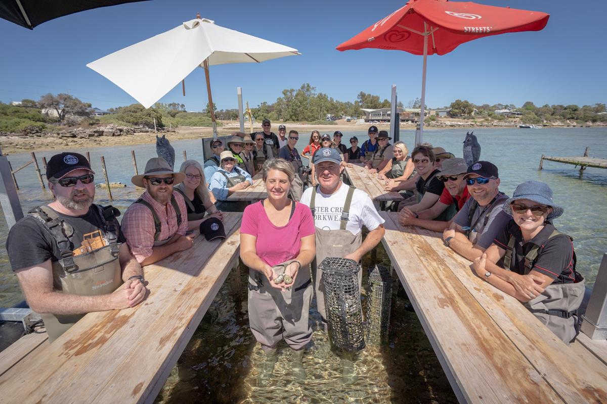
For a quality dining experience there’s the 1802 Oyster Bar or for bistro style dining there’s the Coffin Bay Yacht Club, the Coffin Bay Sports Club in conjunction with 34 Degrees South Catering or the Coffin Bay pub. One thing you must do is to take the Oyster Farm Tour, Ben and Kim run this outstanding diversion from Oyster HQ opposite the caravan park and on the water’s edge.


To get to the National Park from Coffin central simply take the Esplanade all the way around following the Oyster Walk to the park entry via Long Beach Road or follow the signs past the Coffin Bay Hotel.
The bitumen road leads initially to the park entry point where a user-pays system has now been replaced with an on-line system. Not sure that the new system is the better experience because I’m a first-come, first-served kinda guy. But that’s what the minders in Government want us to do now, so you can find a campsite via this link.
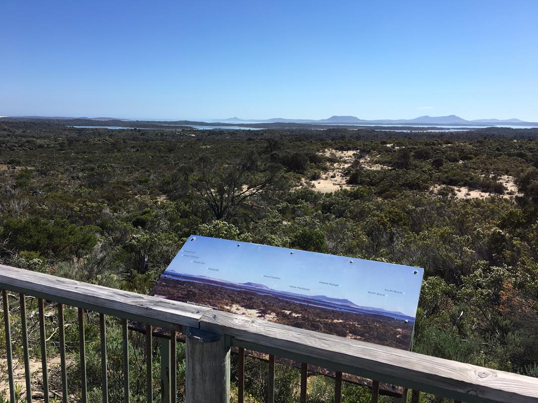
Once you’ve paid your fee follow the blacktop as it meanders through the dunes, a beautiful drive that summits at Templetonia Lookout on the RHS of the road (Templetonia is a native plant in the district), a spot well-worth getting out of the car for a stretch of the legs as the view of the bay and the Marble Range, Mount Dutton and Mount Greenly is superb. Don’t be surprised if you encounter a family of emus along the way as they are a regular feature of the local roads.

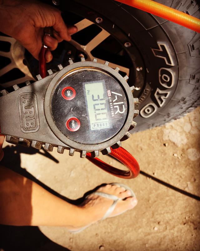
If you were paying attention you would have also seen a sign on the left pointing to Gunyah Beach. The track there is 4WD only, the initial 2 or so kilometres is firm, a gravel/dirt/rock surface is easyish going before a sign warns of the sands ahead for a similar distance to the beach. Airing down is essential and a 50% dump will be required if not more, because Gunyah has a habit of catching people out all the time and is totally unsuited to AWD vehicles with poor clearance and no LOW range.


The drive through the dunes is marked and stunning, dropping down to the beach from the hills above it in one giant panorama. Once at the beach you’ve got a couple of options, a turn to the right won’t take you too far towards Almonta Beach before you run out of driveable beach.
A turn to the left will take you along a longer section of coast that rewards fisher-folk with great schools of salmon, mulloway and mullet and of course bigger fish with big bitey mouths. Be warned, it’s not a good beach to go swimming on unless it’s a day with a small swell and little wind. Probably better you just admire it rather than take a dunk.
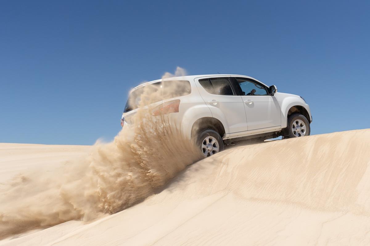
Back in the vehicle you’ll soon discover the sands are SOFT and if you’re used to driving a beach down near the water’s edge that’s firm… well you won’t find it here. Visit knowing you will likely get bogged. Oh and help’s a long time coming. Independent travel thinking is definitely recommended. Pack your MaxTrax or TREDPros and a shovel.


Depending on what time of the year you’re visiting will determine what approach to take. If it’s summer and dry you’ll likely be in LOW range and using all the gears. If you have a vehicle with electronics turn off both stability control and traction control because they will seriously mess with your head applying autonomous braking applications when you don’t want them. On this trail momentum is definitely King!
Back at the junction near Templetonia and after a session on Gunyah if you kept going west on the bitumen you would have bumped into a T-junction, left to Point Avoid (which is a beautiful bitumen coastal drive taking in Point Avoid, Golden Island and Almonta Beach) or right to Yangie Bay.
From the lookout overlooking Almonta Beach I was once rewarded on a glorious autumn day seeing a pod of around 40 dolphins lazily catching waves and rounding up fish. I’ll remember that moment until the day I die, but hey that’s a pretty standard experience in this part of the world.


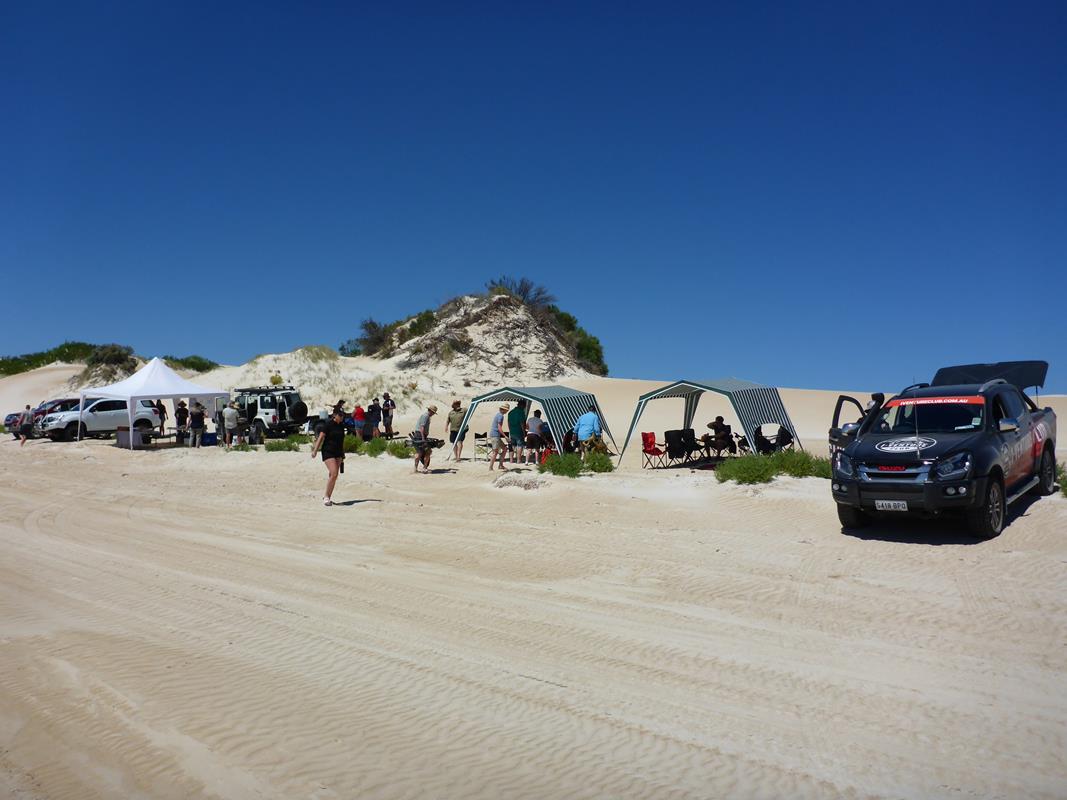
The 4WD interest starts again in earnest via Yangie Bay where the first official formal campsite is located, recently renovated and complete with stunning views and facilities limited to long-drop toilets, some shelter pavilions and walks around the bay’s shoreline. This is where the caravan set usually park up with their rigs. If that is your thing it makes a perfectly good step-off point for 4WD access to the National Park-proper.
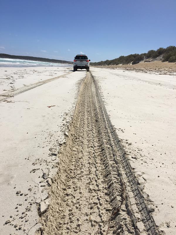
It’s also now that you’ll be on the dirt and it’s time for two things – again some serious tyre pressure reduction and some 4WD engagement, because just around the next corner starts the sand. Put your thinking caps on right now.
In summer the sand here is SOFT (seems to be a common theme). In the first five hundred metres you’ll be bogged if you haven’t gone straight down to 15psi/105kPa, yep 15 psi (if you’re running silly 18″ wheels you might want to keep a couple more psi up your sleeve (18-20psi) because lower pressures might result in a tyre becoming uncoupled from the wheel, it’s all about sidewall height and flex and 18″ are generally crap with a shorter footprint and less bead retention). Now don’t stress about that pressure because it’ll achieve a bunch of things. One is it might preserve a marriage and two it’ll save you looking like a loser because the trail gets busy and that half hour you spend pfaffing around trying to get unstuck will be holding other people up. You don’t need that stress. The other plusses are you’ll preserve the track and also your tyres if you nudge a piece of sharp limestone further into the park.

I’m also a great believer in using LOW range before time. This first tricky section en-route to Lake Jessie and beyond demands LOW range, you’ll multiply the torque output of your vehicle which equals more grunt and more gears to choose from. I’ve towed a fully laden Kimberley Kamper through here across a couple of summers visits and powered through in our Isuzu D-MAX or the MU-X using 2nd, 3rd and 4th gears in LOW when others were busy getting themselves bogged, trying to slug it out in HIGH. If you’re driving an automatic pull it out of DRIVE and stir the gears manually. You’ll exercise more control by keeping that engine busy whilst you plough through the soft sand. Oh and don’t forget to turn off both traction control (TRC) and vehicle stability control (VSC) (VSC will be disabled automatically when you select LOW range).
Away from the edge of the bay and heading slightly inland for a while the grip will be restored as you’ll be running over limestone shelves amongst the vegetation. The track is still only one vehicle width so you might have to yield to on-coming traffic from time to time by ducking into a slot at trackside. You might elect to return to HIGH range for a while as you sail towards Lake Damascus.
If you’re thinking of camping in the park, Black Springs rates highly. A row of around a dozen campsites are perched on a low brow of limestone covered in a Mallee-eucalypt woodland and nestled nicely out of the wind, with one of the best views in the park looking east across the bay to the sentinels of Marble Range, Mt Dutton and Mt Greenly. The only facilities are a pair of long-drops.
If you are a walker the Black Rocks hike is a good thing to do. Whilst the full hike is a 4 hour return journey of 12 kilometres all the way to Black Rocks, I’ve done the shorter walk of around 2.5 hours return to where the track bumps into the cliffs at Avoid Bay. With a Sea Eagle eyrie perched on an obelisk of rock out in front, the wave-swept bay of Sensation Beach to the west and craggy cliffs and pounding surf stretching south-east to Black Rocks and Point Avoid make for a pretty awesome reward for a bit of relatively easy walking.

Meanwhile back on the 4WD trail the track swings north hugging the coast in places and past Point Longnose and running in and out of the dunes before hitting the beach proper at Seven Mile Beach. OMG this is a nice part of the world. The observant amongst you will notice right through this section a grove of Quandong trees and in spring they’re ripe for the picking, just ask the emus!
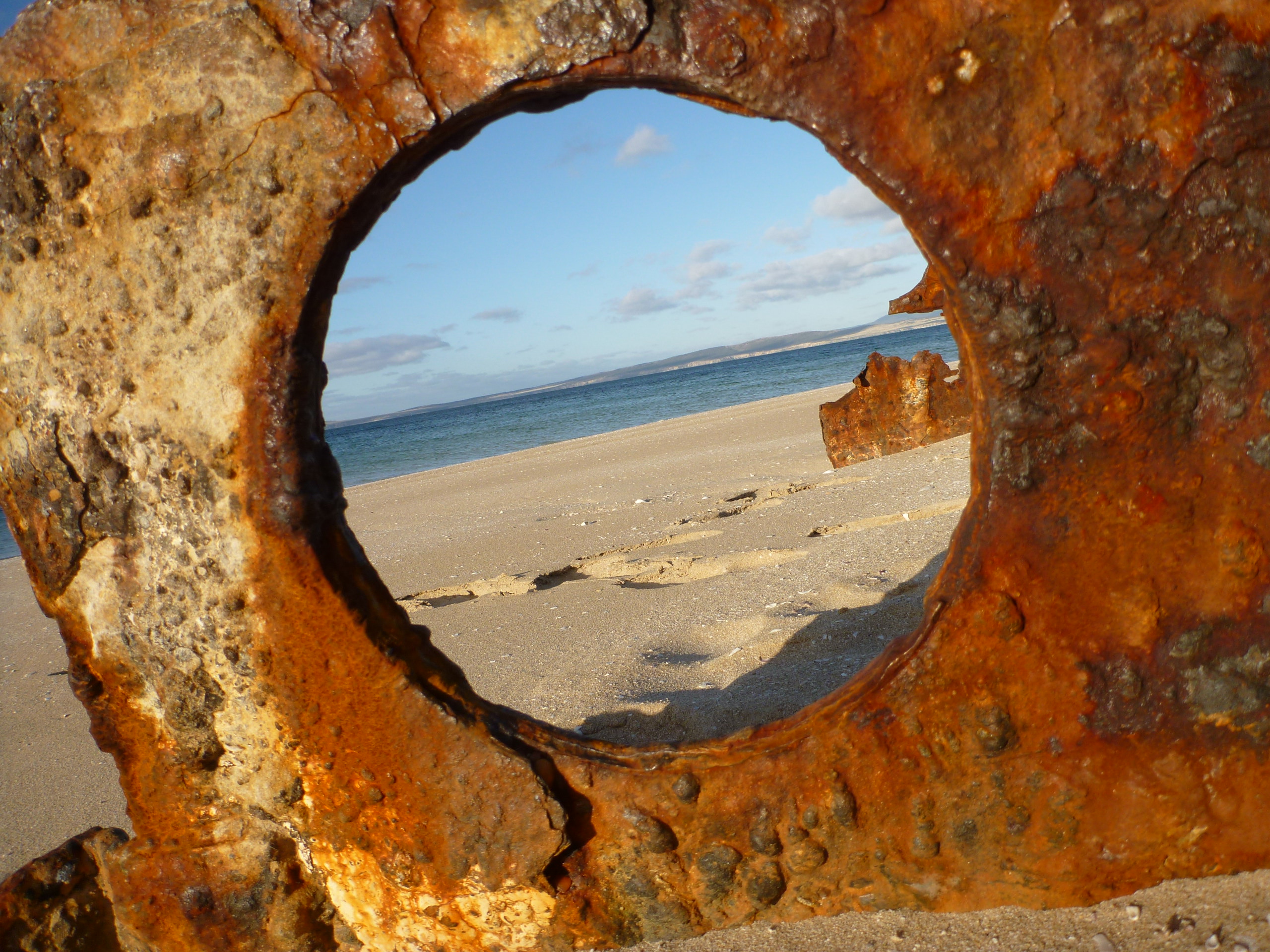
Where the track merges with the beach there’s an exclusion zone to your right (looking east), you’ll know it because there’s the rusting hull of a fishing vessel slowing rotting away into the sand and clearly visible. Turning left and onto the beach stretches the “Seven Miles”, a broad curving part of the bay adjacent to the Thorny Passage Marine Park.


In summer with the milder tides you shouldn’t have any dramas along here as there’s plenty of room between the HIGH and LOW watermarks, but winter and spring needs some caution exercised particularly around a full moon on a high tide, as you might find there’s no beach to run on and the top track is submerged. Thankfully the waters here don’t have the full forces of the sea crashing into them, so wave carnage won’t be a concern if you got bogged. The tyre pressure reduction you did earlier in the day will pay dividends once more, as you should sail through this section with no dramas.
A couple of kilometres into the Seven Mile Beach run and you’ll be alongside the towering sand hill that topples into the bay and it’s worth getting out of the car and walking to the summit. It’s a great escape for the kids and set them a challenge with a race to the top. The reward is a panorama of Coffin Bay, Mt Dutton, Mt Greenly, Point Longnose and up to Point Sir Isaac.


The track ducks back into the hinterland with an option to cross the peninsula to Sensation Beach (named after a fishing boat called the Sensation that ran ashore here in a storm) and some surf fishing or if you wanted to park the car up here overnight (or probably smarter find a campsite at Morgan’s Landing) there’s the Whidbey Wilderness Zone hikes, one called Boarding House Bay and the other simply Whidbey. Both are lengthy (suggested 8 hour return for 24 kilometres distance) and probably deserve an overnight campout with your pup tent.


Back in the middle of the peninsula is where the pastoral activity used to be and the remnant fencing and buildings crumbling into the earth are all that remain of, of all things, a horse stud known as “The Coffin Bay Run”.
A pommy army Captain named Hawson imported 60 Timor ponies to establish a hot temperature breed for toil in the Aussie bush. Having selected a lease on the Coffin Bay Peninsula in 1847 he established a farm and set about building the stud’s stocks up with a “free range” farming style of letting the animals roam and graze pretty much where they pleased. After 10 years of toil he sold the lease and the farm’s stocks to a bloke named Mortlock (now there’s a SA founding name if ever I did hear one) who decided to add some height to the ponies with a bit of mixed breeding. The lease changed hands a couple of times and in 1932 the Morgan family gave it a crack.
The fortunes of raring horses were in decline with the advent of mechanisation and eventually the enterprise became unprofitable, the lease relinquished and the National Park became a reality, leaving a wild mob of horses roaming around.
A mob of feral horses loose in a National Park is contrary to conservation so they had to move on, a cull avoided when a local group wanting to preserve the heritage of the horses took possession of the animals and they now reside on private land over near Wangary and Kellidie Bay.
I can remember back in 1986 seeing the horses grazing, pretty flighty when approached, a really bizarre sight. With the grazing removed gradually the vegetation is returning, likely a good outcome.


Continuing with the horsey-theme, nearby Morgan’s Landing (named after the last lessee) is another fine campsite that looks east towards Farm Beach. Set in the low dunes beyond Seven Mile Beach with Mallee-woodland offering some welcome shade and great views of the bay. Again you’ll find some long drop toilets there. Morgan’s can also be accessed along the beach from Seven Mile Beach or via the inland track.
Heading north to the tip of the peninsula the track goes inland once more past Phantom Cove (isn’t that a great name) and Point Burgess, en-route to The Pool, the last of the remote campsites in the park. It’s a lot like Morgan’s, a view across the bay this time toward Gallipoli Beach.
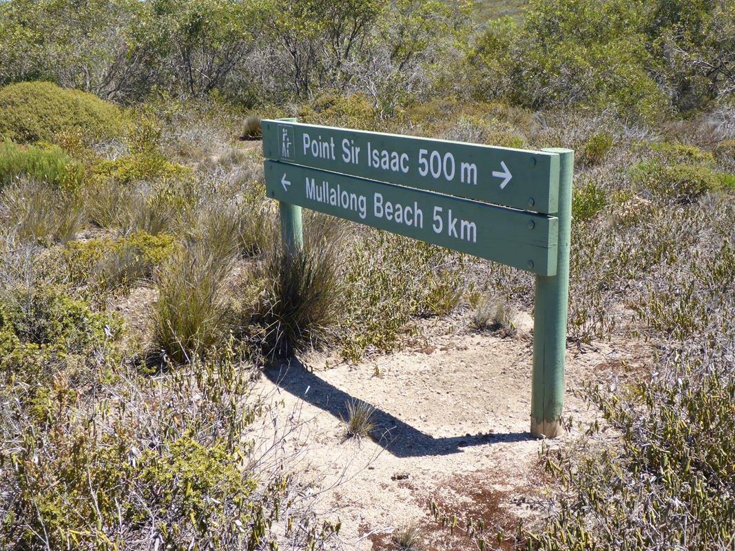
Just beyond The Pool is Point Sir Isaac a little spur that defines Seasick Bay’s eastern-most projection, at the other end are the granites that buffer against the wild seas of the Bight and the Southern Ocean. Seasick Bay’s a pretty place too, a classic lunette shape that cops a little swell as it wraps around the corner. We caught a nice flathead there once upon a time and must have another go sometime.
The 4WD trail continues from the western point of Seasick a short distance south-west in amongst the granite rocks where on another visit I witnessed a family of emus emerging from the nearby scrub and walk to the water’s edge and take a sip from the Southern Ocean… you see some bizarre stuff here.
For the surfers amongst you there’s Mullalong Beach a wave that breaks over a reef around a 100m out that’ll work when there’s any easterly (offshore) breeze. Not for inexperienced surfers this break is difficult to access, as the beach is at the base of a steep limestone hill and coupled to the paddle out you’ll want to be well-practised before you take it on.


If you have a mobile phone, coverage with Telstra is OK in a lot of the park with the exception of the very bottom end and in the hollows between the bigger dunes where it can be a little patchy. Do your homework, do your preparation and let your tyres down and be ready to engage LOW range when things get technical and you should be OK.
So to sum up a Coffin Bay 4WD experience, this is a place that rates highly in my book. It’s so good I bought a holiday rental house in the town a couple of years ago, because I want to visit and soak up the wonders on a regular basis. I love the colour, the lazy days, the beaches, the dining, the local people, the 4WDing opportunities and of course the oysters. You’ll likely never see waters so vivid, sunsets so colourful, a landscape still largely unaffected by us humans, as that you’ll find at the bottom of Eyre Peninsula.
Follow this link to the local tourism association’s info page
Photos thanks to Iain Curry, Mark Harman, Isuzu I-Venture Club, David & Rose Wilson, Adventure 4WD
One Response to “Four Wheel Driving in Coffin Bay – South Australia”
Jayne Noble
Extremely helpful info for driving in the np. We drive a Prado with all the necessary safety gear but are on our own. Needed to get a good understanding of the conditions before we head out. Thank you and we’ll written.